The goal of this lab was to learn our way around downloading data from online and adding it to ArcMap.
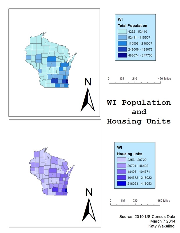
I succesfully downloaded data from the US Cenus website for the above maps. I used total population for the first map and something simple, housing units, for the next. I learned the process of adding an exel file from the internet to ArcMap and how to join it to together the information to make it mapable.
The first map shows the total population of WI through the number of people per county, while the second map show the number of housing units per county. I excpected the two maps to look similar due the fact that if a county has more people if probably has more housing units as well.
Source: http://factfinder2.census.gov/faces/nav/jsf/pages/index.xhtml
 RSS Feed